Plug-in Reforestorie
Open Foris — FAO’s Open‑Source Forest Monitoring Suite
Open Foris is a suite of open‑source tools developed by the FAO to support forest monitoring, land‑use analysis, and MRV systems for climate reporting (REDD+, Article 6.2, NDCs).
It is the global reference for governments building transparent, auditable forest monitoring systems.
What Open Foris provides
National‑scale satellite analysis (Sentinel, Landsat, Planet)
Forest change detection (deforestation, degradation, reforestation)
Field inventory management (tree measurements, plots, biomass)
Carbon stock estimation with uncertainty calculations
Full MRV workflow: Measurement → Reporting → Verification
Key modules
SEPAL — Cloud geospatial processing, classification, change detection
Collect — Field data collection (mobile + desktop)
Calc — Carbon and statistical analysis
GROUND — High‑resolution field mapping
Why it matters for Waterships
Fully open source and sovereign
Recognized by FAO, UNFCCC, World Bank
Perfectly aligned with Article 6.2, ITMOs, and MRV+
Integrates natively into Seahorse Manager as the backbone of national MRV
ImageJ — Scientific Image Analysis for Tree Counting
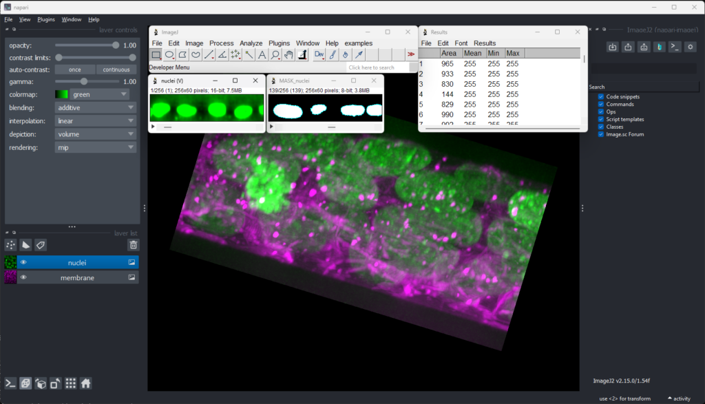
ImageJ is an open‑source scientific image analysis platform developed by the U.S. National Institutes of Health (NIH). It is one of the most powerful tools for segmentation, object detection, and quantitative analysis on high‑resolution images.
What ImageJ provides
Tree crown detection on drone orthomosaics
Automatic tree counting using segmentation workflows
Measurement of canopy area, density, and health indicators
Plugin ecosystem for machine learning, NDVI, multispectral analysis
Batch processing for large drone datasets
Why it matters for Waterships
Essential for reforestation monitoring
Produces tree‑level metrics required for MRV+
Integrates seamlessly into Seahorse Manager as the drone‑analysis engine
Complements Open Foris (satellite + field) with high‑resolution ground truth
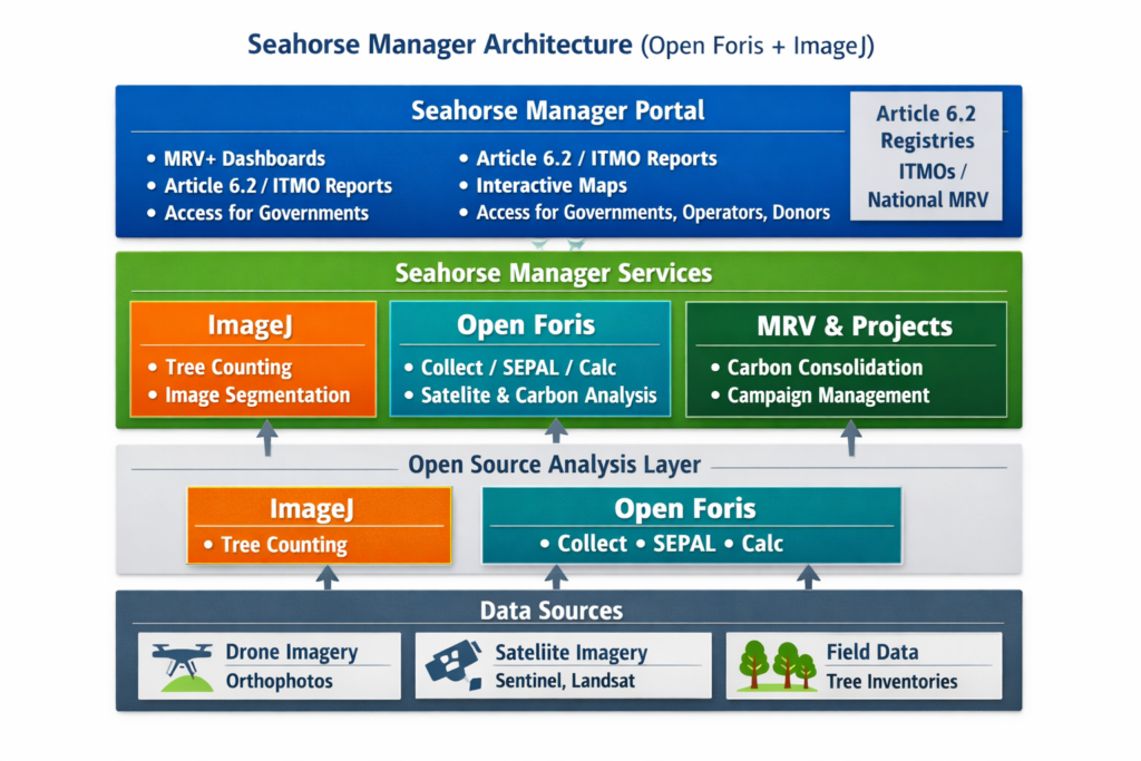
How they work together inside Seahorse Manager
| Component | Role | Data Type | Seahorse Manager Function |
|---|---|---|---|
| Open Foris | Satellite + field MRV | Sentinel, Landsat, field plots | National MRV, carbon, Article 6.2 |
| ImageJ | Drone‑based tree analysis | Orthomosaics | Tree counting, survival, QC |
| Seahorse Manager | Orchestration + dashboards | All sources | MRV+, ITMOs, reporting |
Together, they form a complete sovereign MRV ecosystem for Waterships.